According to the official weather service, the United Kingdom has just suffered through its longest spell of freezing conditions since December 1981.
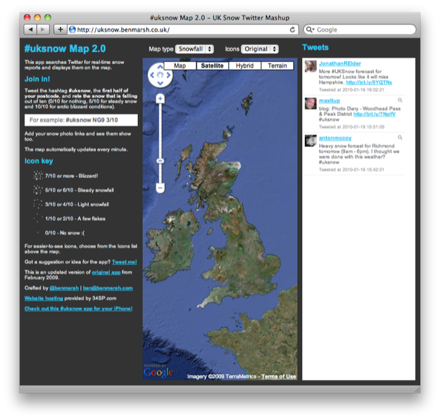
The recent winter storms wreaked havoc with public transportation and generally disrupted the lives of millions of UK residents. In calculating which regions were affected and determining where snow was falling or not and in what amounts, millions of UK residents turned to Twitter. Hundreds of thousands of them also turned to a specific Twitter-based application created by East Midlands resident and freelance web developer, Ben Marsh. The UK Snow Map lets Twitter users report where snow is falling and see those reports on a map in real-time. It works regardless of the cloud cover, which weather satellites do not.
The system works like this: anyone with a Twitter account can report on local snow conditions. The person tweets the hashtag #uksnow, plus their location – either the placename or first half of the local postcode, and a rating of snowfall from 0 (no snow) to 10 (blizzard). Those results are then placed on a map of the UK in real-time through the development expertise of Mr. Marsh – and give a visual reference on the local snow conditions as reported by actual residents on the ground in that location.
The UK Snow Map has been active since last February, but has increased in use exponentially year over year – mirroring the growth in popularity of Twitter in the UK. Last year approximately 50,000 UK residents used the map. This year, the map received 50,000 visits in one day during the height of the snowfall last week. During the recent wintry weather, the application received over 100,000 unique snow reports from all over the UK with rates of over 100 tweets per minute at peak times.